



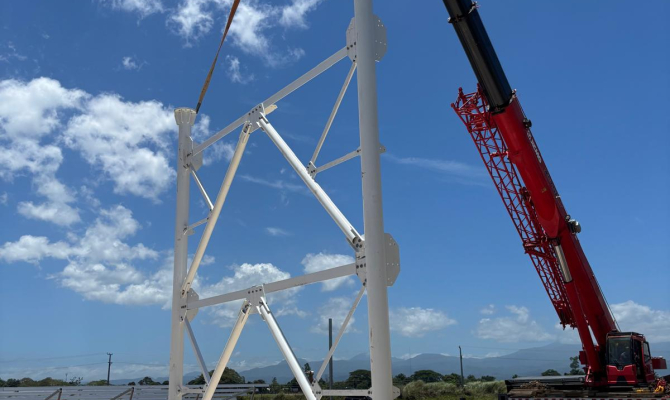
The Solomon Islands’ first weather radar is rising from the ground, with construction now well underway on a facility that will give the nation its own eyes on approaching storms for the first time.
Delivered under the Weather Ready Pacific (WRP) Programme, the project has moved firmly into its construction phase with the technical support of New Zealand MetService and key national stakeholders
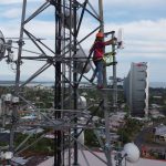
Crews have completed the concrete foundation for the radar tower and are installing a dedicated solar power supply, ensuring the facility has power backup support and runs on clean, renewable energy; a design choice that keeps the radar operating reliably even when the wider power grid is under strain, as often happens during severe weather events.
The commissioning is planned before the end of the year, after which the radar will begin feeding live imagery into the Solomon Islands Meteorological Service’s (SIMS) forecasting and warning systems.
Weather radar transforms how a country sees and responds to severe weather. Rather than waiting for a storm to arrive, forecasters can track rain bands, thunderstorms and tropical cyclones in near real time: seeing where rain is falling, how heavy it is, and which way it is moving.
Director Alick Haruhiru of the Solomon Islands Meteorological Service said, “This radar is a milestone for our country. For the first time, our forecasters will be able to see severe weather as it develops and track it in real time – which means earlier warnings and better protection for our communities. It represents a real step change in what our service can deliver for the people of Solomon Islands.”
For communities, that translates into earlier, sharper warnings. As demonstrated by the region’s first WRP radar in Tonga, radar imagery can be made available to the public so people can see for themselves whether rain is coming and how intense it will be – giving families, farmers, fishers and emergency managers time to plan and prepare.
That lead time is critical in the Pacific.
People in Small Island Developing States (SIDS) are around 15 times more likely to die from climate-related disasters than people elsewhere, according to the UN Environment Programme, a gap that better forecasting and early warnings are designed to close.
The radar also directly supports the UN Secretary-General’s Early Warnings for All initiative, which aims for every person on Earth to be protected by early warning systems by 2027.
For Solomon Islands, an archipelago of nearly a thousand islands spread across vast distances, the benefits are practical and immediate.
The radar will lead to sharper, faster warnings for tropical cyclones, flash flooding and coastal inundation, strengthening the national Multi-Hazard Early Warning System, better-informed decisions for disaster managers, aviation, shipping, agriculture and fisheries and greater protection for lives and livelihoods on the front line of climate change.
The radar will be a resilient, self-sufficient facility, powered by solar energy and built to keep working when it is needed most.
The Solomon Islands radar is part of a coordinated regional effort to close long-standing gaps in weather monitoring across the Pacific.
WRP Programme Manager,’Ofa Fa’anunu, emphasised the importance of the radar for the Solomon Islands.
“The progress in Solomon Islands is exactly what Weather Ready Pacific was designed to deliver: Pacific-led investment that builds lasting national capability,” he said.
“Following Tonga and Vanuatu radar (the latter built through the Van-KIRAP project), and alongside Samoa, Solomon Islands is helping us weave together a connected radar network across the region, guided by the WRP Pacific Radar Strategy.”
Tonga led the way with the first radar delivered under WRP, launched in 2024. Vanuatu followed with a radar delivered through the Van-KIRAP project, feeding directly into its national disaster preparedness system. Samoa is now in the contracting stage with its radar supplier, and Solomon Islands joins this expanding network as construction advances toward commissioning by the end of this year.
These national projects sit within a single regional blueprint – the WRP Pacific Radar Strategy – which sets out a coordinated approach to building radar coverage across the region. The Strategy was endorsed at the 8th Pacific Meteorological Council (PMC-8) in Nuku’alofa, Tonga, in September 2026.