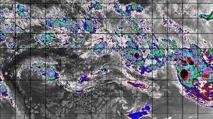
Tropical Cyclone Nat is expected to move north over the Southern Cook Islands over the next 24 to 36 hours as a category one system.
A category one system is at the weaker end of storm systems but still brought the potential for damaging winds, impacting crops and trees and a likelihood of craft dragging their moorings.
From later today, the system is expected to turn to a more easterly track and head towards Tahiti.
MetService said it may bring strong gale force winds to northern parts of the Southern Cooks, as well as heavy rain and moderate to large waves to large parts of the Cook Islands.
“Tropical Low (06U/05F) to the northwest of New Caledonia is currently weak, and is expected to remain in an unfavourable environment for significant development for the first few of days. Consequently, the risk of tropical cyclone (TC) development is low.
“One or two tropical lows may form on the South Pacific Convergence Zone between Samoa and French Polynesia over the next 12 to 24 hours, which may become significant.”
The current status of the cyclone was located over open waters between the Northern and Southern Cook Islands, about 305km north of Palmerston Island as at 7am New Zealand time.
“Maximum winds near the centre were estimated to be 65 km/h with gales extending up to 185km from the centre.
“The system is expected to track quickly east-southeast over the next 24-36 hours tracking just north of the Southern Cook Islands as a category one system, MetService said.
SOURCE: TVNZ/PACNEWS


