The Pacific Meteorological Desk at the Secretariat of the Pacific Regional Environment Programme (SPREP) in Samoa continues to remind Pacific communities to stay vigilant, be prepared and take heed of the correct information and warnings from their National Meteorological and Hydrological Services (NMHS) as the region enters the second half of the cyclone season.
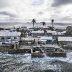
Three Tropical Cyclones have occurred in the south Pacific region this cyclone season. Tropical Cyclone Lola left a trail of devastation across Vanuatu’s northern and central islands in October 2023. This was followed by Tropical Cyclone Mal which affected Fiji and most recently Tropical Cyclone Jasper which hit the Solomon Islands before tracking slowly southwest to north Queensland, Australia, where devastating floods occurred in December.
“We are now in the second half of the cyclone season and historically, this is when we have more cyclones. Therefore, communities need to continue to be prepared and remain vigilant,” said Philip Malsale, Climate and Oceans Support Programme in the Pacific (COSPPac) Climatologist at SPREP.
“We always advise Pacific communities to get up-to-date information from your NMHS for your planning, whether you are a farmer, fisherman or whatever it is you plan to do. It is also important to remember that it does not take a severe cyclone to produce severe impacts. Coastal and river flooding rainfall can occur with a distant, weak, or former cyclone, especially if the system is slow-moving.”
The reminder from the Pacific Met Desk comes as the Australian Community Climate and Earth-System Simulator – Seasonal (ACCESS-S) model forecast for January 2024 predicts the region’s rainfall patterns. It shows below normal rainfall is likely or very likely for southern Palau, eastern Federated States of Micronesia (FSM), central Republic of Marshall Islands (RMI), the southern Papua New Guinea (PNG) EEZ, southern Solomon Islands, New Caledonia, Vanuatu, Fiji, northern and southern Tonga, Wallis and Futuna, Samoa, American Samoa, parts of Niue, parts of northern and southern Cook Islands, the southern Line Islands, northeastern French Polynesia and Pitcairn Islands.
The ACCESS-S model forecast also shows above normal rainfall is likely or very likely for Commonwealth of the Northern Mariana Islands (CNMI), Guam, PNG’s Islands and most of PNG’s mainland, Nauru, Kiribati, Gilbert, most of Phoenix and northern half of the Line Islands.
“Two major climate hazards we are faced with at the moment are we are still in the cyclone season and in an El Nino event so people can expect lower than normal rainfall in some countries. While others will experience greater risk of tropical cyclone, or both,” Malsale added.
“The three-month rainfall outlook for January to March 2024 is very similar to the December outlook, but with the below normal rainfall region being stronger and extending further west over Palau, FSM, RMI.
“In the southern hemisphere, the below normal region was more intense and more extensive over New Caledonia, Vanuatu, but largely absent from Wallis and Futuna, Samoa, and American Samoa. The above-normal rainfall region also more intense in the three-month outlook from PNG northern mainland across the Islands eastwards to northern Cook Island. In addition, the above normal rainfall region is also broader, extending further south to Tuvalu, Tokelau, the northern to central Cook Islands and then to the southeast over central French Polynesia.”
The key climate drivers are the current El Nino event which is responsible for the shift in rainfall patterns due to the shifts in Warm Pool, the Intertropical Convergence Zone (ITCZ) and South Pacific Convergence Zone (SPCZ) which also influence the shift in the sea surface temperatures. These have a cascading effect in other weather and climate variables, explains SPREP’s Meteorology and Climatology Adviser, Salesa Nihmei.
“Climate change signal is embedded in the intensity and frequency of these drivers,” said Nihmei.
“We have passed the peak of the current El Nino event and predict to be back at ENSO neutral phase in mid-2024. But we need to be cautious since we will be going to our dry season, so we need to prepare ourselves especially those countries/islands that depend entirely on rainfall water. We have another driver (a positive phase of Madden Julian Oscillation) coming through before end of January and can provide some rainfall and also can elevate risk of tropical cyclone for the southwest Pacific.”
So how can communities prepare?
Said Nihmei: “Our message has and will always be for all our Pacific communities to ensure that they stay informed and get the relevant information from National Meteorological and Hydrological Services (NMHS) and not from social media because this often creates panic. We also urge communities to work with relevant government stakeholders and all relevant organisations to prepare for cyclones and how to deal with impacts of El Nino in different sectors.
SOURCE: SPREP/PACNEWS
